la mise en valeur des données pédologiques anciennes a été effectuée pour les canton de VD, GE et Fribourg. Les projet suivants appartiennent à cette problématique.
Canton de VD: Projet de valorisation des données pédologiques historique s dans le canton de Vaud
Mise en valeur des données pédologiques de Michel Gratier: calibration des données, modélisation de paramètres tels que profondeur, texture, calcaire, validation indépendantes à l’aide de 500 points répartis dans 5 zones dans tout le canton.
- Durée du projet/Projektlaufzeit: 2019-2022
- Mandant / Auftraggeber: Canton de Vaud, Division géologie, sols et déchets (GEODE) et Direction générale du territoire et du logement (DGTL)
- Personne de contact / Kontaktperson: Stéphane Burgos
Canton de GE: Projet de valorisation des données pédologiques historique dans le canton de Genève
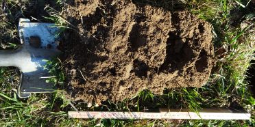
digitalisation des anciens sondages papiers, vérification de 200 pour la calibration des description, modélisation des paramètres tels que profondeur, texture, calcaire, validation indépendantes avec 200 points.
Canton de Fribourg: Projet d’évaluation de la diversité pédologique du canton de Fribourg
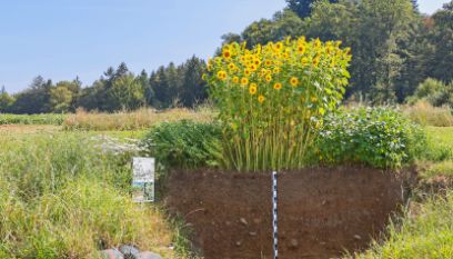
200 sondages pédologiques seront effectués aux emplacement du réseau d’observation FRIBO pour documenter le type de sol et l’adéquation avec les cartes géologiques et la forme du relief.
- Durée du projet/Projektlaufzeit: 2022
- Mandant / Auftraggeber: Service de l'environnement Sen, Section EIE, sol et sécurité des installations
- Personne de contact / Kontaktperson: Stéphane Burgos
- Projektinformationen